DIGITAL TRANSFORMATION UAV
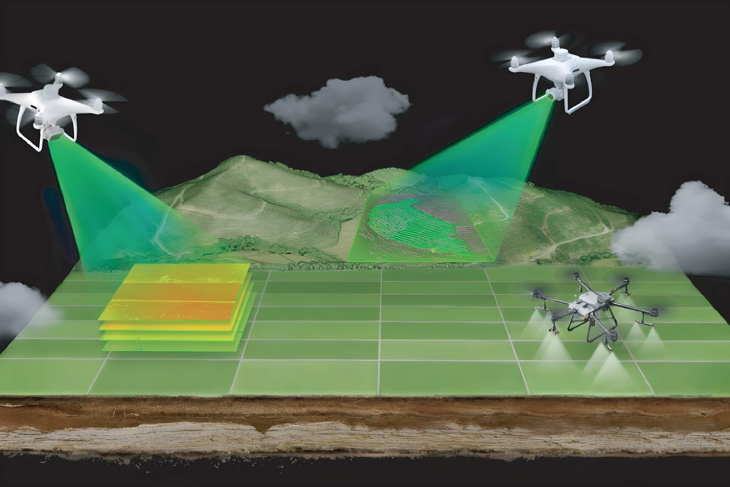
UAV Digital Transformation is the powerful combination of Unmanned Aerial Vehicle (UAV) and Artificial Intelligence (AI) technology, architecting a comprehensive 15-layer Digital Twin.
Management, Planning, and Forecasting
UAV-based digitization, combined with the DT15 platform, enhances the efficiency of urban, resource, and infrastructure management. It empowers planners to make more accurate decisions and improves forecasting capabilities, leading to optimized resource allocation and timely responses.

Comprehensive Spatial Digitization
This process ranges from detailed 2D/3D mapping of terrain and structures to creating a Digital Twin that encompasses the airspace, surface, and even subterranean levels, forming the foundation for intelligent management

/Automated Flight Planning
: Flight missions are pre-programmed at the Flight Coordination Center, defining technical parameters such as altitude, camera angle, and image overlap. This plan is then synchronized with the ground control stations of the field flight teams.
Automated Point of Interest (POI) Identification
After collection, raw data is processed by specialized software to identify locations that require more detailed investigation automatically.
Automated Reporting
Post-flight results are automatically compiled into intelligent, visual reports, enabling management to make rapid and informed decisions.